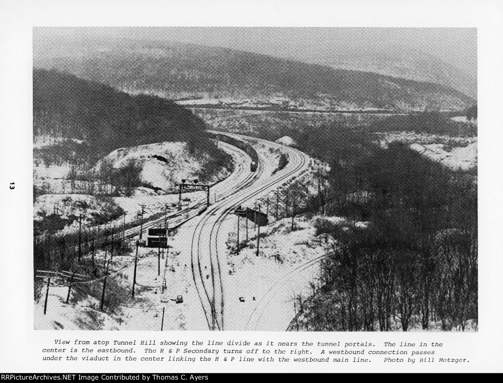
| Here is page 13 of a 28-page booklet entitled "Rail Guide To The Horseshoe Curve." It was published originally in 1976 by PC Publications of East McKeesport, PA. Photo Caption: "View from atop Tunnel Hill showing the line divide as it nears the tunnel portals. The line in the center is {he eastbound. The H & P Secondary turns off to the right. A westbound connection passes under the viaduct in the center linking the H & P line with the westbound main line. Photo by Bill Metzger." |
| Date:
8/15/1976 |
Location:
Gallitzin, PA Map  |
Views:
112 |
Collection Of:
  Thomas C. Ayers
 |
|
Author: Thomas C. Ayers
|
 |
| Picture Categories: Tunnel,Bridge,Winter,Signal |
This picture is part of album: PC: "Rail Guide To The Horseshoe Curve" ~ 1976 *** |